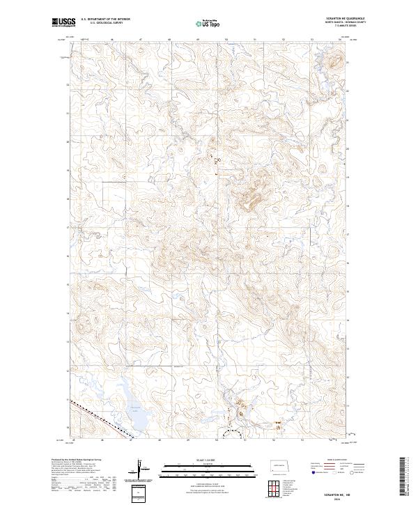
2024 Map of Scranton NE
USGS Topo · Published 2024About this map
Gascoyne Lake and the winding course of Buffalo Creek define the southern landscape of this Bowman County region. The terrain is characterized by the expansive drainage patterns of the northern Great Plains, where South Cedar Creek cuts through the northern sections of the township. This 2024 survey illustrates a rural infrastructure centered on the section line grid, including distinct local routes such as Whiskey Rd and Mine Rd. The map serves as a contemporary record of land use and water resources, reflecting the enduring agricultural character of the North Dakota prairies while documenting the modern hydrography of the Missouri River watershed.
Find a feature on this map
11 named features on this map. Tap any name to fly to it.
Don’t see what you’re looking for? This feature index may not catch every label — zoom into the map to look around manually.
Map Details
Editions of this 2024 Scranton NE Map
This is the sole edition of this map. No revisions or reprints were ever made.
Other maps of this area

1953 · Dickinson
USGS Topo · 1:250,000

1957 · Dickinson
USGS Topo · 1:250,000

1969 · Scranton
USGS Topo · 1:24,000

1969 · Gascoyne
USGS Topo · 1:24,000

1969 · Reeder
USGS Topo · 1:24,000

1969 · Scranton NE
USGS Topo · 1:24,000

1973 · Warnke Hill
USGS Topo · 1:24,000

1973 · Mineral Springs
USGS Topo · 1:24,000
1973 · Scranton SW
USGS Topo · 1:24,000

1973 · Cedar Lake
USGS Topo · 1:24,000