
1969 Map of Scranton NE
USGS Topo · Published 1971About this map
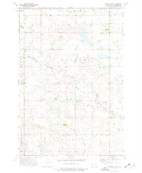
Gascoyne Lake dominates the southern landscape of this 1969 topographic study, where Buffalo Creek feeds into the reservoir just north of the Chicago Milwaukee St Paul and Pacific railroad line. The map captures the edge of the Gascoyne Corporate Bdy, providing a look at the infrastructure of Bowman County before further modern development. The terrain is defined by the high ground of Buena Vista and Fischbein, while the presence of a Gravel Pit and a designated Picnic Area near the lakeshore suggests a mix of local industry and recreation. Detailed survey markings like Stillwater and various scattered Well sites reflect the rural land use and water management priorities managed by the State of North Dakota Water Commission under Governor William L. Guy.
Find a feature on this map
10 named features on this map. Tap any name to fly to it.
Don’t see what you’re looking for? This feature index may not catch every label — zoom into the map to look around manually.
Map Details
Editions of this 1969 Scranton NE Map
This is the sole edition of this map. No revisions or reprints were ever made.
Other maps of this area

1953 · Dickinson
USGS Topo · 1:250,000

1957 · Dickinson
USGS Topo · 1:250,000

1969 · Scranton
USGS Topo · 1:24,000

1969 · Gascoyne
USGS Topo · 1:24,000

1969 · Reeder
USGS Topo · 1:24,000

1973 · Warnke Hill
USGS Topo · 1:24,000

1973 · Mineral Springs
USGS Topo · 1:24,000
1973 · Scranton SW
USGS Topo · 1:24,000

1973 · Cedar Lake
USGS Topo · 1:24,000

1980 · Mott
USGS Topo · 1:100,000