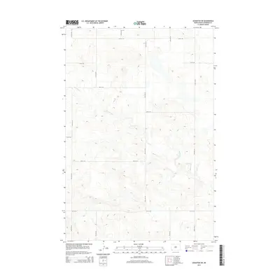
2014 Map of Scranton SW
USGS Topo · Published 2014About this map
Lightning Creek meanders through this portion of Bowman County, carving a subtle drainage pattern across the prairie landscape. The area is defined by a rigid section-line road network characteristic of the Great Plains, with routes such as 135th Ave SW and 95th St SW providing the primary access for the region's agricultural operations. The terrain is marked by gentle undulations and scattered depressions, reflecting the post-glacial topography of the southwestern Dakotas. While largely devoid of concentrated settlements, the map illustrates the expansive scale of rural land management in the early 21st century, where the primary infrastructure consists of these gravel and dirt section-line roads reaching toward isolated homesteads and ranching outposts along Lightning Creek.
Find a feature on this map
15 named features on this map. Tap any name to fly to it.
Don’t see what you’re looking for? This feature index may not catch every label — zoom into the map to look around manually.
Map Details
Editions of this 2014 Scranton SW Map
This is the sole edition of this map. No revisions or reprints were ever made.
Other maps of this area

1935 · Reva
USGS Topo · 1:125,000

1953 · Dickinson
USGS Topo · 1:250,000

1954 · Lemmon
USGS Topo · 1:250,000

1957 · Dickinson
USGS Topo · 1:250,000

1957 · Lemmon
USGS Topo · 1:250,000

1968 · Haley
USGS Topo · 1:24,000

1968 · Bowman-Haley Dam
USGS Topo · 1:24,000

1968 · Tepee Buttes
USGS Topo · 1:24,000

1969 · Scranton
USGS Topo · 1:24,000

1969 · Gascoyne
USGS Topo · 1:24,000