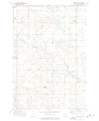
1973 Map of Scranton SW
USGS Topo · Published 1977About this map
Union Prairie Church stands as a focal point for the rural community in this corner of Bowman County during the early 1970s. The landscape is defined by the winding course of Lightning Creek, which drains toward the southeast across several township boundaries. Large-scale land divisions including Scranton, Whiting, Goldfield, Boyesen, and Minnehaha organize the prairie into a distinct grid of sections and roads typical of North Dakota's agricultural heartland. Small-scale industrial activity is evident through a scattered Gravel Pit and isolated Well sites, indicating the local reliance on natural resources. The topography, mapped by the Geological Survey using 1972 aerial photography, reveals a complex series of intermittent drainages and small depressions across the open plains.
Find a feature on this map
9 named features on this map. Tap any name to fly to it.
Don’t see what you’re looking for? This feature index may not catch every label — zoom into the map to look around manually.
Map Details
Editions of this 1973 Scranton SW Map
This is the sole edition of this map. No revisions or reprints were ever made.
Other maps of this area

1935 · Reva
USGS Topo · 1:125,000

1953 · Dickinson
USGS Topo · 1:250,000

1954 · Lemmon
USGS Topo · 1:250,000

1957 · Dickinson
USGS Topo · 1:250,000

1957 · Lemmon
USGS Topo · 1:250,000

1968 · Haley
USGS Topo · 1:24,000

1968 · Bowman-Haley Dam
USGS Topo · 1:24,000

1968 · Tepee Buttes
USGS Topo · 1:24,000

1969 · Scranton
USGS Topo · 1:24,000

1969 · Gascoyne
USGS Topo · 1:24,000