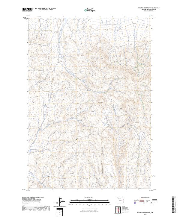
2023 Map of Scratch Post Butte
USGS Topo · Published 2023About this map
High desert water management and remote livestock grazing routes define this Malheur County landscape. The map centers on the prominent volcanic forms of Circle Butte and Scratch Post Butte, overlooking a network of ephemeral drainage systems including Cow Creek and Lyman Creek. This modern survey reveals the infrastructure necessary for life in this arid region, most notably the Smith Reservoir and Wheaton Cr Reservoir, which capture runoff from the surrounding uplands. A rare named access point, Bonita Rd, snakes through the western portion of the quadrangle, serving as the primary corridor for movement between the higher elevations and the deep incisions of Hay Canyon. Small but critical water sources like Kink Spring remain vital landmarks for those navigating the eastern slopes above Log Creek and Birch Creek.
Find a feature on this map
25 named features on this map. Tap any name to fly to it.
Don’t see what you’re looking for? This feature index may not catch every label — zoom into the map to look around manually.
Map Details
Editions of this 2023 Scratch Post Butte Map
This is the sole edition of this map. No revisions or reprints were ever made.
Other maps of this area

1955 · Baker
USGS Topo · 1:250,000

1959 · Baker
USGS Topo · 1:250,000

1964 · Bridgeport
USGS Topo · 1:62,500

1964 · Brogan
USGS Topo · 1:62,500

1964 · Ironside
USGS Topo · 1:62,500

1966 · Clover Creek Ranch
USGS Topo · 1:62,500

1980 · Brogan
USGS Topo · 1:100,000
1990 · Brady Creek
USGS Topo · 1:24,000
1990 · Ironside
USGS Topo · 1:24,000
1990 · Scratch Post Butte
USGS Topo · 1:24,000