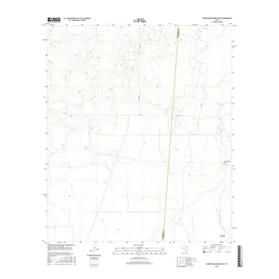
2016 Map of Screw Bean Draw East
USGS Topo · Published 2016About this map
Screw Bean Spring sits at the heart of this arid West Texas landscape, where ephemeral drainage patterns reveal the movement of water across the High Plains. The map captures a section of the Trans-Pecos region near the Culberson and Reeves County line, a boundary defined by isolated ranch roads and natural draws. Human activity is marked by the transit corridor of FM 652 and Carlsbad Rd, which cut through the open terrain. Seasonal waterways like Salt Cr, Screw Bean Draw, and Charlie Ross Draw illustrate the subtle topography of the Chihuahuan Desert, showing how the land is sculpted by infrequent but significant weather events in this remote corner of the state.
Find a feature on this map
8 named features on this map. Tap any name to fly to it.
Don’t see what you’re looking for? This feature index may not catch every label — zoom into the map to look around manually.
Map Details
Editions of this 2016 Screw Bean Draw East Map
This is the sole edition of this map. No revisions or reprints were ever made.
Other maps of this area

1925 · Orla 2-b
USGS Topo · 1:48,000

1931 · Orla
USGS Topo · 1:62,500

1954 · Van Horn
USGS Topo · 1:250,000

1954 · Pecos
USGS Topo · 1:250,000

1957 · Pecos
USGS Topo · 1:250,000

1958 · Van Horn
USGS Topo · 1:250,000

1968 · Threemile Draw
USGS Topo · 1:24,000

1968 · Orla
USGS Topo · 1:24,000
1968 · Red Bluff
USGS Topo · 1:24,000

1973 · Owl Hills
USGS Topo · 1:24,000