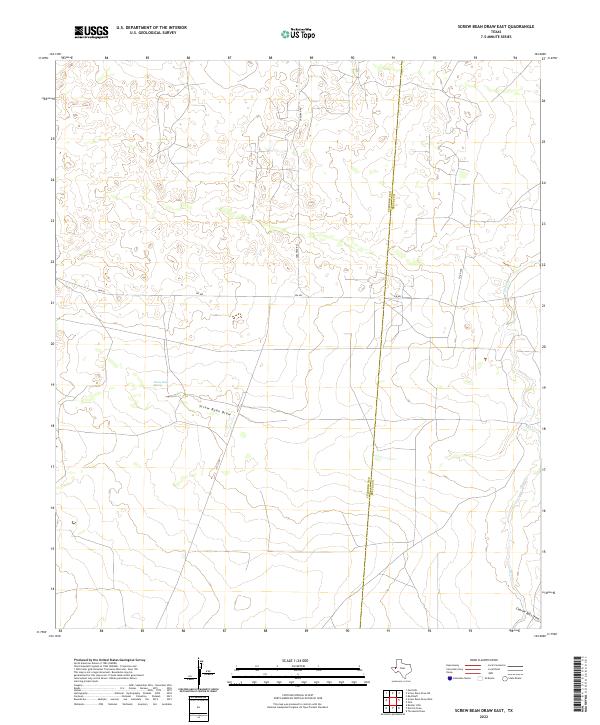
2022 Map of Screw Bean Draw East
USGS Topo · Published 2022About this map
Screw Bean Spring serves as a vital hydrological marker in this arid Trans-Pecos landscape along the border of Culberson and Reeves counties. This 2022 survey documents a sparsely populated region defined by ephemeral watercourses and vital desert infrastructure. The primary transit corridor, Fm 652, cuts east-to-west across the terrain, intersected by Carlsbad Rd as it moves toward the northern boundary. The drainage patterns are clearly defined by the branching paths of Screw Bean Draw and Salt Cr, which provide essential topographic context for understanding the local watershed. In the southeastern corner, Charlie Ross Draw enters the frame, further illustrating the complex network of dry washes that dominate the geography of this West Texas expanse.
Find a feature on this map
8 named features on this map. Tap any name to fly to it.
Don’t see what you’re looking for? This feature index may not catch every label — zoom into the map to look around manually.
Map Details
Editions of this 2022 Screw Bean Draw East Map
This is the sole edition of this map. No revisions or reprints were ever made.
Other maps of this area

1925 · Orla 2-b
USGS Topo · 1:48,000

1931 · Orla
USGS Topo · 1:62,500

1954 · Van Horn
USGS Topo · 1:250,000

1954 · Pecos
USGS Topo · 1:250,000

1957 · Pecos
USGS Topo · 1:250,000

1958 · Van Horn
USGS Topo · 1:250,000

1968 · Threemile Draw
USGS Topo · 1:24,000

1968 · Orla
USGS Topo · 1:24,000
1968 · Red Bluff
USGS Topo · 1:24,000

1973 · Owl Hills
USGS Topo · 1:24,000