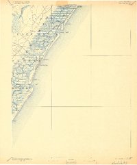
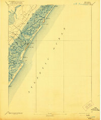
1894 Map of Sea Isle
USGS Topo · Published 1900About this map
The coastal barrier islands of southern New Jersey appear in their late 19th-century state, dominated by the emerging Sea Isle City and the vital infrastructure of the Life-Saving Service. The map illustrates a landscape of intricate tidal waterways and salt marshes, with prominent inlets like Corson Inlet and Townsend Inlet cutting through the beach strands. The West Jersey Railroad Sea Isle and Ocean City Branch provides the primary connection between the mainland settlements of Seaville and Ocean View and the burgeoning seaside resorts.
Find a feature on this map
52 named features on this map. Tap any name to fly to it.
Don’t see what you’re looking for? This feature index may not catch every label — zoom into the map to look around manually.
Map Details
Editions of this 1894 Sea Isle Map
6 editions found

Other maps of this area

1884 · Sea Isle
USGS Topo · 1:62,500

1887 · Atlantic City
USGS Topo · 1:62,500

1888 · Cape May
USGS Topo · 1:62,500

1888 · Dennisville
USGS Topo · 1:62,500

1888 · Sea Isle
USGS Topo · 1:62,500

1890 · Great Egg Harbor
USGS Topo · 1:62,500

1890 · Tuckahoe
USGS Topo · 1:62,500

1893 · Cape May
USGS Topo · 1:62,500

1893 · Great Egg Harbor
USGS Topo · 1:62,500

1893 · Tuckahoe
USGS Topo · 1:62,500