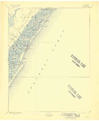
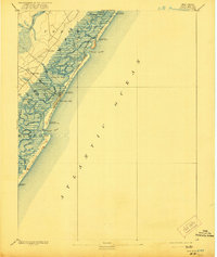
1894 Map of Sea Isle
USGS Topo · Published 1909About this map
The barrier islands and intricate marshlands of Cape May County are captured here during a period of expanding coastal transit. Sea Isle City stands as the primary hub of activity, reached by the West Jersey Railroad City Branch and Ocean Sea Isle. The landscape is defined by a dense network of tidal waterways, including the Corson Sound and Townsend Sound, which are separated by numerous small channels like Ben Hands Thoro and Jonadab Thoro. This intricate topography reflects the natural complexity of the New Jersey shore before modern dredging and development significantly altered the inland bays. Along the Atlantic coast, the map documents the vital presence of the Life-Saving Service, with several installations including L.S. Station Corson Inlet and L.S. Station Sea Isle City positioned to assist vessels navigating the shifting shoals of Corson Inlet and Townsend Inlet.
Find a feature on this map
52 named features on this map. Tap any name to fly to it.
Don’t see what you’re looking for? This feature index may not catch every label — zoom into the map to look around manually.
Map Details
Editions of this 1894 Sea Isle Map
6 editions found

Other maps of this area

1884 · Sea Isle
USGS Topo · 1:62,500

1887 · Atlantic City
USGS Topo · 1:62,500

1888 · Cape May
USGS Topo · 1:62,500

1888 · Dennisville
USGS Topo · 1:62,500

1888 · Sea Isle
USGS Topo · 1:62,500

1890 · Great Egg Harbor
USGS Topo · 1:62,500

1890 · Tuckahoe
USGS Topo · 1:62,500

1893 · Cape May
USGS Topo · 1:62,500

1893 · Great Egg Harbor
USGS Topo · 1:62,500

1893 · Tuckahoe
USGS Topo · 1:62,500