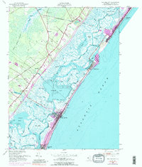
1952 Map of Sea Isle City
USGS Topo · Published 1989About this map
The coastal barrier islands and intricate marshlands of Cape May County are documented here during a period of transition in the mid-20th century. Sea Isle City and Strathmere anchor the shoreline, separated by the dynamic Corson Inlet, while the Pennsylvania-Reading Seashore Lines provides the critical rail link between the mainland and the coast. Inland, the landscape is defined by the expansive Great Cedar Swamp and small settlements like Seaville and Palermo.
Find a feature on this map
53 named features on this map. Tap any name to fly to it.
Don’t see what you’re looking for? This feature index may not catch every label — zoom into the map to look around manually.
Map Details
Editions of this 1952 Sea Isle City Map
6 editions found
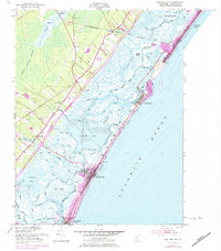
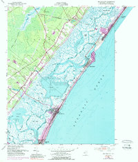
Other maps of this area

1884 · Sea Isle
USGS Topo · 1:62,500

1888 · Dennisville
USGS Topo · 1:62,500

1888 · Sea Isle
USGS Topo · 1:62,500

1890 · Great Egg Harbor
USGS Topo · 1:62,500

1890 · Tuckahoe
USGS Topo · 1:62,500

1893 · Great Egg Harbor
USGS Topo · 1:62,500

1893 · Tuckahoe
USGS Topo · 1:62,500

1894 · Dennisville
USGS Topo · 1:62,500

1894 · Sea Isle
USGS Topo · 1:62,500

1918 · Great Egg Harbor
USGS Topo · 1:62,500