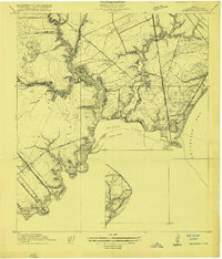
1932 Map of Seabrook
USGS Topo · Published 1946About this map
League City and Seabrook anchor this coastal landscape during the late interwar period, when the western edge of Galveston Bay was defined by small fishing communities and early bay-front developments. The maritime character of the region is evident in the Dredged Channel cutting through Clear Lake, connecting the interior waterways to the open bay. To the north, the Old Middle Bayou School serves as a reminder of the rural educational network established before the post-war suburban expansion. The infrastructure of the era is captured through the Southern Pacific rail line and the Galveston Houston Electric route, which facilitated movement between the burgeoning metropolitan centers and the gulf coast. Smaller enclaves like Killkare, Clear Lake Shores, and Glen Cove highlight the early 20th-century trend of establishing waterfront retreats and residential hubs along the intricate bayous and inlets.
Find a feature on this map
39 named features on this map. Tap any name to fly to it.
Don’t see what you’re looking for? This feature index may not catch every label — zoom into the map to look around manually.
Map Details
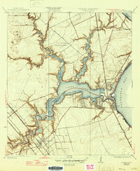
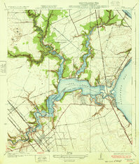
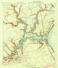
Editions of this 1932 Seabrook Map
3 editions found
Historical Maps of Houston Through Time
3 maps found