Loading...
Loading map...1932 Map of Seabrook
USGS Topo · Published 1932About this map
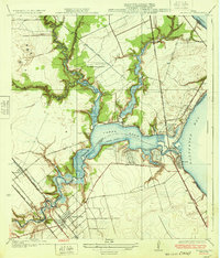
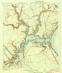
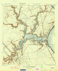
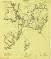
Clear Creek and Clear Lake dominate this 1932 coastal survey, revealing a landscape defined by the convergence of Harris and Galveston counties. At the mouth of the lake, the Seabrook and Kemah settlements are linked by the Clear Lake Bridge, while the Southern Pacific railroad follows the shoreline of Galveston Bay. This era shows a mix of established rail-line towns like Webster and League City and smaller waterfront developments such as Clear Lake Shores, Glen Cove, and Lakeside.
Find a feature on this map
44 named features on this map. Tap any name to fly to it.
Don’t see what you’re looking for? This feature index may not catch every label — zoom into the map to look around manually.
Map Details
Date Portrayed1932
Date Published1932
PublisherU.S. Geological Survey
Map TypeTopographic
Scale1:31,680
Physical Dimensions17 x 19.9 inches
Editions of this 1932 Seabrook Map
3 editions found
Historical Maps of Houston Through Time
3 maps found

Featured Locations
Source Details
SourceU.S. Geological Survey
CopyrightPublic Domain