
1970 Map of Seagraves SE
USGS Topo · Published 1973About this map
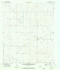
McKenzie Draw carves a subtle path across this West Texas landscape, winding through a region heavily defined by energy extraction in the early 1970s. The terrain is marked by a dense network of industrial infrastructure, characterized by an extensive Oil Field and Gas Field that dominate the southeastern quadrant. This 1970 survey shows a landscape saturated with resource development, where numerous Wells, Gas Wells, and a dedicated Pumping Sta underscore the subterranean wealth of the Permian Basin. Away from the primary drilling zones, scattered Gravel Pits suggest local material extraction, while a geometric grid of roads and an intersecting Pipeline network organize the surface. The map captures Gaines County at a peak of petroleum activity, documenting the precise placement of infrastructure used to tap into the regional oil and gas reserves.
Find a feature on this map
8 named features on this map. Tap any name to fly to it.
Don’t see what you’re looking for? This feature index may not catch every label — zoom into the map to look around manually.
Map Details
Editions of this 1970 Seagraves SE Map
This is the sole edition of this map. No revisions or reprints were ever made.
Other maps of this area

1954 · Hobbs
USGS Topo · 1:250,000

1958 · Hobbs
USGS Topo · 1:250,000

1969 · Loop
USGS Topo · 1:24,000

1970 · Seagraves SW
USGS Topo · 1:24,000

1970 · Seminole NE
USGS Topo · 1:24,000

1970 · McKenzie Lake NW
USGS Topo · 1:24,000

1970 · Seagraves
USGS Topo · 1:24,000
1970 · Loop SW
USGS Topo · 1:24,000

1970 · Seagraves NW
USGS Topo · 1:24,000

1970 · Seminole
USGS Topo · 1:24,000