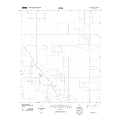
2010 Map of Seagraves SW
USGS Topo · Published 2010About this map
The Seminole Oil Field and O D C Oil Field define the industrial character of this West Texas landscape in the early twenty-first century. This portion of Gaines County is marked by a dense grid of service roads, including Co RD 211 and Co RD 218, which support the extensive petroleum infrastructure. The terrain is otherwise dominated by the natural drainage patterns of Wardswell Draw and McKenzie Draw, which provide the only significant topographic variation across the plains. The concentration of road networks around the Seminole Oil Field illustrates the intense land use dedicated to resource extraction, showing the intersection of natural geography and the energy economy.
Find a feature on this map
21 named features on this map. Tap any name to fly to it.
Don’t see what you’re looking for? This feature index may not catch every label — zoom into the map to look around manually.
Map Details
Editions of this 2010 Seagraves SW Map
This is the sole edition of this map. No revisions or reprints were ever made.
Other maps of this area

1954 · Hobbs
USGS Topo · 1:250,000

1958 · Hobbs
USGS Topo · 1:250,000

1970 · Seagraves SW
USGS Topo · 1:24,000

1970 · Seminole NE
USGS Topo · 1:24,000

1970 · Seagraves SE
USGS Topo · 1:24,000

1970 · Seagraves
USGS Topo · 1:24,000

1970 · Seagraves NW
USGS Topo · 1:24,000

1970 · Seminole
USGS Topo · 1:24,000

1971 · Paynes Corner
USGS Topo · 1:24,000
1971 · Denver City
USGS Topo · 1:24,000