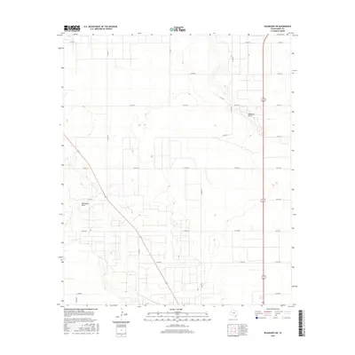
2016 Map of Seagraves SW
USGS Topo · Published 2016About this map
McKenzie Draw and Wardswell Draw define the subtle topography of this West Texas landscape in Gaines County. The map reveals a structured grid of rural roads, such as Co Rd 216 and Co Rd 203, reflecting the region's agricultural and ranching organization. This geometric layout is punctuated by ephemeral drainage features that cut across the High Plains, providing a clear record of land division and water management in a semi-arid environment. Local property boundaries and access points are meticulously documented through a network of county roads, including Co Rd 212 and Co Rd 205, which serve as the primary infrastructure for this sparsely populated portion of the Llano Estacado.
Find a feature on this map
26 named features on this map. Tap any name to fly to it.
Don’t see what you’re looking for? This feature index may not catch every label — zoom into the map to look around manually.
Map Details
Editions of this 2016 Seagraves SW Map
This is the sole edition of this map. No revisions or reprints were ever made.
Other maps of this area

1954 · Hobbs
USGS Topo · 1:250,000

1958 · Hobbs
USGS Topo · 1:250,000

1970 · Seagraves SW
USGS Topo · 1:24,000

1970 · Seminole NE
USGS Topo · 1:24,000

1970 · Seagraves SE
USGS Topo · 1:24,000

1970 · Seagraves
USGS Topo · 1:24,000

1970 · Seagraves NW
USGS Topo · 1:24,000

1970 · Seminole
USGS Topo · 1:24,000

1971 · Paynes Corner
USGS Topo · 1:24,000
1971 · Denver City
USGS Topo · 1:24,000