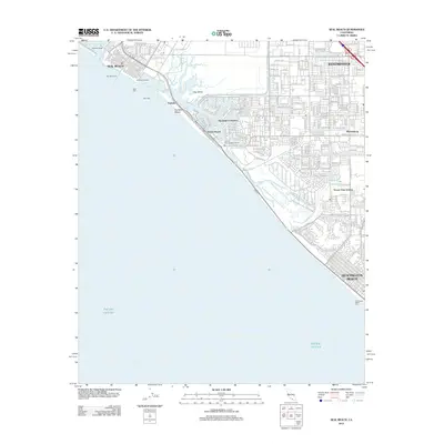
2012 Map of Seal Beach
USGS Topo · Published 2012About this map
Seal Beach and Huntington Beach anchor this coastal survey, where the urbanization of Orange County meets the complex hydrology of the Pacific Ocean shoreline. The landscape is defined by the engineered waterways of Huntington Harbour and the protected marshes of the Ecological Reserve near Bolsa Bay. Residential development is dense in the northern interior, with neighborhoods like Westminster and Wintersburg showing a tight grid of streets that contrast with the open expanses of Anaheim Bay and Hog Island. Maritime infrastructure is a central theme, from the Seal Beach Pier and Huntington Beach Pier to the protective West and East Jetty structures at the harbor entrance. Notable residential enclaves such as Seaside Village, Surfside, and Ocean View Estates are clearly mapped, reflecting the late 20th-century growth of this famous coastal corridor.
Find a feature on this map
27 named features on this map. Tap any name to fly to it.
Don’t see what you’re looking for? This feature index may not catch every label — zoom into the map to look around manually.
Map Details
Editions of this 2012 Seal Beach Map
This is the sole edition of this map. No revisions or reprints were ever made.
Other maps of this area

1896 · Santa Ana
USGS Topo · 1:62,500

1896 · Anaheim
USGS Topo · 1:62,500

1896 · Las Bolsas
USGS Topo · 1:62,500

1896 · Downey
USGS Topo · 1:62,500

1898 · Anaheim
USGS Topo · 1:62,500

1899 · Downey
USGS Topo · 1:62,500

1901 · Southern California Sheet No. 1
USGS Topo · 1:250,000

1901 · Santa Ana
USGS Topo · 1:62,500

1901 · Anaheim
USGS Topo · 1:62,500

1902 · Downey
USGS Topo · 1:62,500