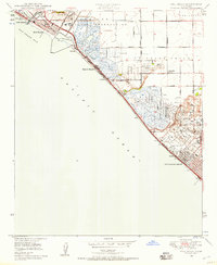
1949 Map of Seal Beach
USGS Topo · Published 1957About this map
Los Alamitos Naval Reservation occupies a significant portion of the northern coastal interior, situated just inland from the coastal settlements of Seal Beach and Surfside. The landscape is a complex network of wetlands and tidal flats, defined by Anaheim Bay, Sunset Bay, and Bolsa Bay, with Hog Island sitting between the dikes and marshes. The transport corridor is anchored by the Pacific Electric railroad and the Coast Highway, which trace the narrow strip of land between the Pacific and the bays. To the south, the economy of the late 1940s is visibly dominated by extensive Oil Wells fields near Huntington Beach and Rocamp. Inland, small community hubs like Wintersburg and Los Patos sit near recreational and specialized sites such as the La Bolsa Chica Gun Club, the Meadowlark Golf Club, and the East Long Beach Airport.
Find a feature on this map
44 named features on this map. Tap any name to fly to it.
Don’t see what you’re looking for? This feature index may not catch every label — zoom into the map to look around manually.
Map Details
Editions of this 1949 Seal Beach Map
2 editions found
Other maps of this area

1896 · Santa Ana
USGS Topo · 1:62,500

1896 · Anaheim
USGS Topo · 1:62,500

1896 · Las Bolsas
USGS Topo · 1:62,500

1896 · Downey
USGS Topo · 1:62,500

1898 · Anaheim
USGS Topo · 1:62,500

1899 · Downey
USGS Topo · 1:62,500

1901 · Southern California Sheet No. 1
USGS Topo · 1:250,000

1901 · Santa Ana
USGS Topo · 1:62,500

1901 · Anaheim
USGS Topo · 1:62,500

1902 · Downey
USGS Topo · 1:62,500