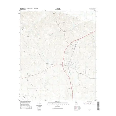
2014 Map of Seale
USGS Topo · Published 2014About this map
Seale serves as a central hub in this part of Russell County, where the intersection of Us-431 and Al-169 anchors the local geography. The area is characterized by a high concentration of family and community burial grounds, including Saint Peters Cem, Boykin Cem, and Key Cem, which offer significant value for genealogical research in this Alabama landscape. The settlement patterns follow the winding paths of several creeks and branches, most notably Silver Run and Watermelon Cr, which drain the undulating terrain.
Find a feature on this map
81 named features on this map. Tap any name to fly to it.
Don’t see what you’re looking for? This feature index may not catch every label — zoom into the map to look around manually.
Map Details
Editions of this 2014 Seale Map
This is the sole edition of this map. No revisions or reprints were ever made.
Other maps of this area

1914 · Seale
USGS Topo · 1:62,500

1949 · Fort Mitchell
USGS Topo · 1:24,000

1950 · Crawford
USGS Topo · 1:24,000

1950 · Seale
USGS Topo · 1:24,000

1950 · Phenix City
USGS Topo · 1:24,000

1950 · Seale
USGS Topo · 1:62,500

1955 · Phenix City
USGS Topo · 1:24,000

1955 · Seale
USGS Topo · 1:24,000

1955 · Crawford
USGS Topo · 1:24,000
1955 · Fort Mitchell
USGS Topo · 1:24,000