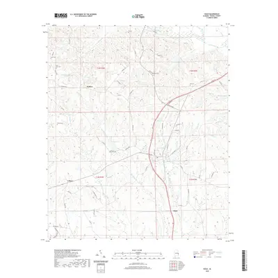
2020 Map of Seale
USGS Topo · Published 2020About this map
Sandfort and the surrounding Russell County countryside are defined by a network of creeks and family cemeteries that trace the region's long rural history. Several burial grounds, including Saint Peter Cem, Key Cem, and the Williams Dudley Cem, are distributed among the undulating hills, offering specific points of interest for genealogical research. The landscape is carved by numerous watercourses such as Uchee Creek and Silver Run, which have historically shaped the settlement patterns and local road networks. Small communities like Colbert and Villula anchor different corners of the map, connected by routes like Sandfort Rd and Poorhouse Rd. This documentation captures the modern configuration of a traditional agricultural and residential landscape, where local landmarks like Dudleys Lake and Monte Pond remain significant features of the interior drainage system.
Find a feature on this map
70 named features on this map. Tap any name to fly to it.
Don’t see what you’re looking for? This feature index may not catch every label — zoom into the map to look around manually.
Map Details
Editions of this 2020 Seale Map
This is the sole edition of this map. No revisions or reprints were ever made.
Other maps of this area

1914 · Seale
USGS Topo · 1:62,500

1949 · Fort Mitchell
USGS Topo · 1:24,000

1950 · Crawford
USGS Topo · 1:24,000

1950 · Seale
USGS Topo · 1:24,000

1950 · Phenix City
USGS Topo · 1:24,000

1950 · Seale
USGS Topo · 1:62,500

1955 · Phenix City
USGS Topo · 1:24,000

1955 · Seale
USGS Topo · 1:24,000

1955 · Crawford
USGS Topo · 1:24,000
1955 · Fort Mitchell
USGS Topo · 1:24,000