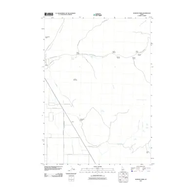
2010 Map of Seamans Creek
USGS Topo · Published 2010About this map
Bellevue Cemetery sits at the edge of this high-desert landscape in south-central Idaho, where the Wood River Valley begins to climb into the foothills. The area is defined by a sophisticated irrigation network that has supported local agriculture for generations, visible in the detailed paths of District Canal Forty-Five and Canal Number 45. Beyond the valley floor, the terrain rises into prominent landforms such as Cowcatcher Ridge and Lookout Mountain. To the east, the map documents a rugged series of drainages, including Rattlesnake Canyon, Sharps Canyon, and Big Dry Canyon, leading toward the high grazing grounds of Josper Flats. This 2010 survey also identifies several important water sources in this arid environment, ranging from Italian Spring to Barrel Springs, which were vital for early ranching and homesteading efforts near the settlement of Balaam.
Find a feature on this map
45 named features on this map. Tap any name to fly to it.
Don’t see what you’re looking for? This feature index may not catch every label — zoom into the map to look around manually.
Map Details
Editions of this 2010 Seamans Creek Map
This is the sole edition of this map. No revisions or reprints were ever made.
Other maps of this area

1895 · Hailey
USGS Topo · 1:125,000

1897 · Hailey
USGS Topo · 1:125,000

1955 · Hailey
USGS Topo · 1:250,000

1957 · Bellevue
USGS Topo · 1:62,500

1957 · Bellevue
USGS Topo · 1:24,000

1959 · Hailey
USGS Topo · 1:250,000

1962 · Hailey
USGS Topo · 1:250,000

1967 · Baugh Creek SW
USGS Topo · 1:24,000

1967 · Baugh Creek
USGS Topo · 1:24,000

1967 · Hailey
USGS Topo · 1:24,000