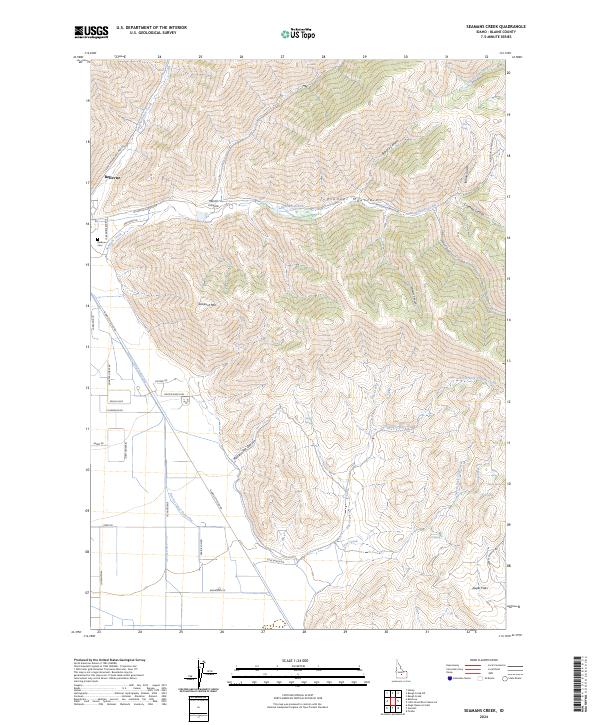
2024 Map of Seamans Creek
USGS Topo · Published 2024About this map
Bellevue anchors the northwestern edge of this modern Idaho landscape, where the foothills of the Pioneer Mountains meet the agricultural plains of Blaine County. The terrain is defined by a dense network of high-elevation canyons, including Muldoon Canyon and Rattlesnake Canyon, which funnel seasonal drainage toward the valley floor. Water management is a central theme here, evidenced by the engineered paths of District Canal Forty-five and Canal Number 45, which support the ranches and homesteads scattered along Gannett Picabo Rd.
Find a feature on this map
53 named features on this map. Tap any name to fly to it.
Don’t see what you’re looking for? This feature index may not catch every label — zoom into the map to look around manually.
Map Details
Editions of this 2024 Seamans Creek Map
This is the sole edition of this map. No revisions or reprints were ever made.
Other maps of this area

1895 · Hailey
USGS Topo · 1:125,000

1897 · Hailey
USGS Topo · 1:125,000

1955 · Hailey
USGS Topo · 1:250,000

1957 · Bellevue
USGS Topo · 1:62,500

1957 · Bellevue
USGS Topo · 1:24,000

1959 · Hailey
USGS Topo · 1:250,000

1962 · Hailey
USGS Topo · 1:250,000

1967 · Baugh Creek SW
USGS Topo · 1:24,000

1967 · Baugh Creek
USGS Topo · 1:24,000

1967 · Hailey
USGS Topo · 1:24,000