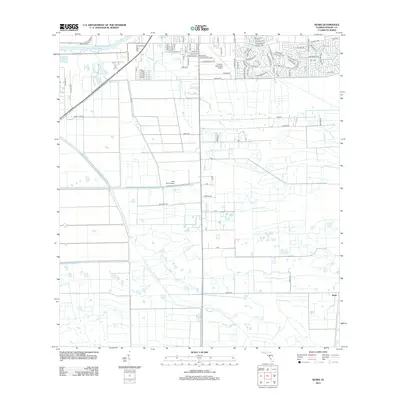
2012 Map of Sears
USGS Topo · Published 2012About this map
The Caloosahatchee River defines the northern edge of this landscape in Hendry County, providing a vital waterway for this agricultural region. Inland, the map reveals a pattern of citrus cultivation and aviation infrastructure, with sites like Berry Citrus and Bob Paul Grv sitting alongside two distinct airstrips: La Belle Municipal Airport and the privately listed Bob Paul Airport. The residential and commercial footprint of the area is concentrated south of the river, where street names like Orange Ave and Tangerine Ave reflect the local economy. Further south, the settlement of Sears stands as a primary point of reference in an area otherwise characterized by large agricultural blocks and a network of drainage-aligned roads such as Murray Rd and Huggetts Rd.
Find a feature on this map
89 named features on this map. Tap any name to fly to it.
Don’t see what you’re looking for? This feature index may not catch every label — zoom into the map to look around manually.
Map Details
Editions of this 2012 Sears Map
This is the sole edition of this map. No revisions or reprints were ever made.
Other maps of this area

1956 · West Palm Beach
USGS Topo · 1:250,000

1957 · West Palm Beach
USGS Topo · 1:250,000

1957 · Telegraph Swamp SE
USGS Topo · 1:24,000

1958 · West Palm Beach
USGS Topo · 1:250,000

1958 · Felda SE
USGS Topo · 1:24,000

1958 · Goodno
USGS Topo · 1:24,000

1958 · Felda
USGS Topo · 1:24,000

1958 · Felda NE
USGS Topo · 1:24,000

1958 · Alva
USGS Topo · 1:24,000

1958 · Sears
USGS Topo · 1:24,000