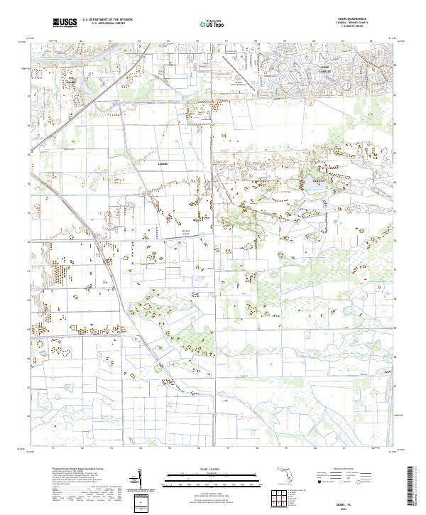
2024 Map of Sears
USGS Topo · Published 2024About this map
The Caloosahatchee River winds across the northern edge of this landscape, serving as a historic corridor for the Okeechobee Waterway Canoe Trl and linking the settlements of Fort Denaud, LaBelle, and the expanding residential grid of Port LaBelle. South of these communities, the terrain shifts into a highly organized agricultural and drainage system. This transition is marked by the extensive Bob Paul Groves and the linear path of the Roberts Canal, which cuts diagonally across the township lines.
Find a feature on this map
65 named features on this map. Tap any name to fly to it.
Don’t see what you’re looking for? This feature index may not catch every label — zoom into the map to look around manually.
Map Details
Editions of this 2024 Sears Map
This is the sole edition of this map. No revisions or reprints were ever made.
Other maps of this area

1956 · West Palm Beach
USGS Topo · 1:250,000

1957 · West Palm Beach
USGS Topo · 1:250,000

1957 · Telegraph Swamp SE
USGS Topo · 1:24,000

1958 · West Palm Beach
USGS Topo · 1:250,000

1958 · Felda SE
USGS Topo · 1:24,000

1958 · Goodno
USGS Topo · 1:24,000

1958 · Felda
USGS Topo · 1:24,000

1958 · Felda NE
USGS Topo · 1:24,000

1958 · Alva
USGS Topo · 1:24,000

1958 · Sears
USGS Topo · 1:24,000