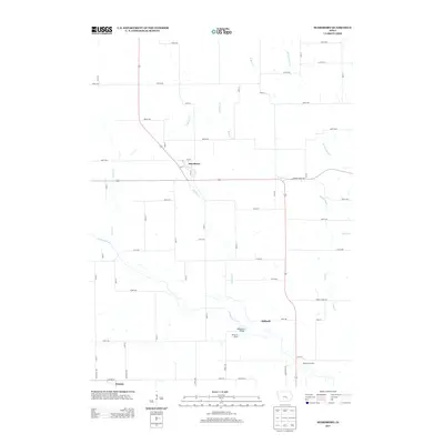
2013 Map of Searsboro
USGS Topo · Published 2013About this map
The town of Searsboro sits at the heart of this agricultural landscape in Poweshiek County, where the regular geometry of Iowa's section roads meets the winding course of the N Skunk River. This 2013 survey illustrates the enduring rural character of the region, anchored by small settlements like Taintor and Stillwell. The river and its tributaries, including English Cr, W Buck Cr, and Sugar Cr, define the topography and drainage of the fertile plains. Local landmarks such as the McDowell Bridge and public recreational areas like Millgrove Access and Robertson Access provide specific points of interest for researchers studying the modern intersection of infrastructure and natural watercourses. The map provides a precise record of the localized road network, from named avenues like 465th Ave to numbered streets that structure the rural countryside.
Find a feature on this map
59 named features on this map. Tap any name to fly to it.
Don’t see what you’re looking for? This feature index may not catch every label — zoom into the map to look around manually.
Map Details
Editions of this 2013 Searsboro Map
This is the sole edition of this map. No revisions or reprints were ever made.
Other maps of this area

1910 · Pella
USGS Topo · 1:62,500

1912 · Pella
USGS Topo · 1:62,500

1954 · Des Moines
USGS Topo · 1:250,000

1956 · Des Moines
USGS Topo · 1:250,000

1957 · Des Moines
USGS Topo · 1:250,000

1969 · Des Moines
USGS Topo · 1:250,000

1979 · Montezuma
USGS Topo · 1:24,000

1979 · Searsboro
USGS Topo · 1:24,000

1979 · Grinnell South
USGS Topo · 1:24,000
1979 · Malcom
USGS Topo · 1:24,000