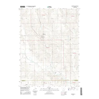
2015 Map of Searsboro
USGS Topo · Published 2015About this map
Searsboro sits at the heart of this rural Iowa landscape, situated along a network of country roads like Diamond Trail Rd and State Route 146. The surrounding terrain is defined by the winding course of the North Skunk River in the south, where the McDowell Bridge provides a crossing point near the Mahaska County line. Tributaries such as English Cr, Sugar Cr, and several branches of Buck Cr carve through the agricultural sections, shaping the local topography.
Find a feature on this map
43 named features on this map. Tap any name to fly to it.
Don’t see what you’re looking for? This feature index may not catch every label — zoom into the map to look around manually.
Map Details
Editions of this 2015 Searsboro Map
This is the sole edition of this map. No revisions or reprints were ever made.
Other maps of this area

1910 · Pella
USGS Topo · 1:62,500

1912 · Pella
USGS Topo · 1:62,500

1954 · Des Moines
USGS Topo · 1:250,000

1956 · Des Moines
USGS Topo · 1:250,000

1957 · Des Moines
USGS Topo · 1:250,000

1969 · Des Moines
USGS Topo · 1:250,000

1979 · Montezuma
USGS Topo · 1:24,000

1979 · Searsboro
USGS Topo · 1:24,000

1979 · Grinnell South
USGS Topo · 1:24,000
1979 · Malcom
USGS Topo · 1:24,000