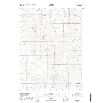
2018 Map of Searsboro
USGS Topo · Published 2018About this map
Searsboro sits as a central hub in this section of rural Poweshiek County, where the agricultural landscape is carved by a dense network of watercourses including English Cr and the North Skunk River. The town itself is marked by its Po and the nearby Searsboro International Order of Odd Fellows Cem, reflecting the fraternal organizations common to Iowa's early settlement history. To the south, the village of Taintor straddles the Mahaska County line, served by Co HWY g13.
Find a feature on this map
44 named features on this map. Tap any name to fly to it.
Don’t see what you’re looking for? This feature index may not catch every label — zoom into the map to look around manually.
Map Details
Editions of this 2018 Searsboro Map
This is the sole edition of this map. No revisions or reprints were ever made.
Other maps of this area

1910 · Pella
USGS Topo · 1:62,500

1912 · Pella
USGS Topo · 1:62,500

1954 · Des Moines
USGS Topo · 1:250,000

1956 · Des Moines
USGS Topo · 1:250,000

1957 · Des Moines
USGS Topo · 1:250,000

1969 · Des Moines
USGS Topo · 1:250,000

1979 · Montezuma
USGS Topo · 1:24,000

1979 · Searsboro
USGS Topo · 1:24,000

1979 · Grinnell South
USGS Topo · 1:24,000
1979 · Malcom
USGS Topo · 1:24,000