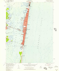
1953 Map of Seaside Park
USGS Topo · Published 1957About this map
Barnegat Bay separates the mainland from a densely developed barrier island in this mid-century topographic study. The narrow strip of land is home to a continuous string of shore communities including Chadwick, Lavallette, and Seaside Heights, where the grid-like street patterns are bordered by a prominent Boardwalk facing the Atlantic Ocean. Connectivity to the mainland is anchored by the Thomas A Mathis Bridge, which crosses Pelican Island to reach the western shores of Toms River.
Find a feature on this map
36 named features on this map. Tap any name to fly to it.
Don’t see what you’re looking for? This feature index may not catch every label — zoom into the map to look around manually.
Map Details
Editions of this 1953 Seaside Park Map
3 editions found
Other maps of this area

1888 · Barnegat
USGS Topo · 1:62,500

1888 · Asbury Park
USGS Topo · 1:62,500

1893 · Asbury Park
USGS Topo · 1:62,500

1893 · Barnegat
USGS Topo · 1:62,500

1898 · Barnegat
USGS Topo · 1:62,500

1901 · Asbury Park
USGS Topo · 1:62,500

1902 · Navesink
USGS Topo · 1:125,000

1919 · Barnegat
USGS Topo · 1:62,500

1919 · Asbury Park
USGS Topo · 1:62,500

1941 · Toms River
USGS Topo · 1:62,500