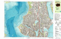
1983 Map of Seattle North
USGS Topo · Published 1983About this map
The University of Washington campus and its surroundings define the eastern landscape of this early 1980s urban survey. Along the shores of Lake Washington and Lake Union, the map reveals a city deeply integrated with its waterways, featuring the Ship Canal and the industrial activity at Fishermens Terminal. Residential neighborhoods like Ballard, Greenwood, and Wallingford show the dense gridiron street patterns that characterized the city's northern expansion. To the west, the expansive Fort Lawton Mil Res occupies the promontory at West Point, while the eastern shore is marked by the presence of Magnuson Park and the extensive grounds of St Edwards State Park. The transition from historic industrial sites like Gas Works Park to established residential communities highlights the changing functional geography of the metropolitan area during this era.
Find a feature on this map
152 named features on this map. Tap any name to fly to it.
Don’t see what you’re looking for? This feature index may not catch every label — zoom into the map to look around manually.
Map Details
Editions of this 1983 Seattle North Map
2 editions found
Other maps of this area

1894 · Seattle
USGS Topo · 1:62,500

1895 · Snohomish
USGS Topo · 1:125,000

1897 · Seattle
USGS Topo · 1:125,000

1908 · Seattle
USGS Topo · 1:62,500

1909 · Seattle Special
USGS Topo · 1:62,500

1937 · Port Orchard
USGS Topo · 1:62,500

1937 · Port Gamble
USGS Topo · 1:62,500

1940 · Port Gamble
USGS Topo · 1:62,500

1942 · Edmonds
USGS Topo · 1:62,500

1944 · Everett
USGS Topo · 1:62,500