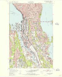
1949 Map of Seattle South
USGS Topo · Published 1956About this map
Boeing Field and the sprawling industrial corridors of the Duwamish River dominate this post-war landscape of South Seattle. The map details the city's complex mid-century transport network, where the Lake Washington Pontoon Bridge connects the city to East Seattle and four major railroads—the Northern Pacific, Union Pacific, Great Northern, and Chicago Milwaukee St Paul and Pacific—converge along the waterfront. Residential growth is evident in the grid patterns of Highland Park, Rainier Valley, and Yesler Terrace. This era represents the peak of Seattle's industrial aviation and maritime identity, visible in the intensive development of Harbor Island and the many slips of the East Waterway. Beyond the industry, the map documents community landmarks from Sicks Stadium to the Veterans Hospital and schools like Garfield High Sch.
Find a feature on this map
66 named features on this map. Tap any name to fly to it.
Don’t see what you’re looking for? This feature index may not catch every label — zoom into the map to look around manually.
Map Details
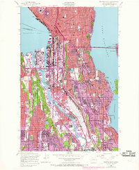
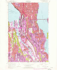
Editions of this 1949 Seattle South Map
3 editions found
Other maps of this area

1894 · Seattle
USGS Topo · 1:62,500

1895 · Snohomish
USGS Topo · 1:125,000

1897 · Tacoma
USGS Topo · 1:125,000

1897 · Seattle
USGS Topo · 1:125,000

1900 · Tacoma
USGS Topo · 1:125,000

1908 · Seattle
USGS Topo · 1:62,500

1909 · Seattle Special
USGS Topo · 1:62,500

1949 · Shilshole Bay
USGS Topo · 1:24,000

1949 · Renton
USGS Topo · 1:24,000
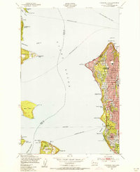
1949 · Duwamish Head
USGS Topo · 1:24,000