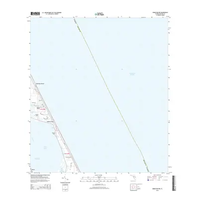
2015 Map of Sebastian NW
USGS Topo · Published 2015About this map
The narrow barrier islands and sheltered lagoons of the Florida coast are defined here by a series of residential developments and protected waterways. Communities like Floridana Beach, Evans Pines, and Ballard Pines occupy the thin strip of land between the Atlantic Ocean and the Indian River Lagoon. The map illustrates the specialized geography of this coastline, where many local roads such as Aquarina Blvd and Hammock Shore Dr terminate at the water's edge.
Find a feature on this map
32 named features on this map. Tap any name to fly to it.
Don’t see what you’re looking for? This feature index may not catch every label — zoom into the map to look around manually.
Map Details
Editions of this 2015 Sebastian NW Map
This is the sole edition of this map. No revisions or reprints were ever made.
Other maps of this area

1949 · Fellsmere
USGS Topo · 1:24,000

1949 · Melbourne East
USGS Topo · 1:24,000

1949 · Sebastian NW
USGS Topo · 1:24,000

1949 · Sebastian
USGS Topo · 1:24,000

1949 · Grant
USGS Topo · 1:24,000

1951 · Sebastian NW
USGS Topo · 1:24,000

1951 · Melbourne East
USGS Topo · 1:24,000

1951 · Fellsmere
USGS Topo · 1:24,000

1951 · Grant
USGS Topo · 1:24,000

1951 · Sebastian
USGS Topo · 1:24,000