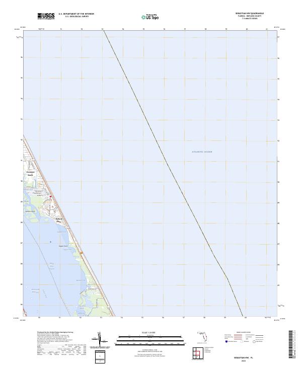
2024 Map of Sebastian NW
USGS Topo · Published 2024About this map
Archie Carr National Wildlife Refuge dominates the Atlantic coastline of this barrier island landscape, preserving a critical stretch of Brevard County shore. This modern survey illustrates the narrow, residential corridors of Floridana Beach and Ballard Pines, where neighborhoods are positioned between the ocean and the complex estuarine environment of the Indian River Lagoon. The map details the intricate waterways of the Intracoastal Waterway, including smaller sheltered areas like Ballard Cove, Pepper Cove, and Mathers Cove. Navigation and recreation are central to this area, evidenced by the Florida Circumnavigational Paddling Trl threading through Mullet Creek and past Latham Island. The land is characterized by these tidal exchanges, with Long Point Creek and the Mud Hole defining the interior wetlands west of the primary coastal dunes.
Find a feature on this map
35 named features on this map. Tap any name to fly to it.
Don’t see what you’re looking for? This feature index may not catch every label — zoom into the map to look around manually.
Map Details
Editions of this 2024 Sebastian NW Map
This is the sole edition of this map. No revisions or reprints were ever made.
Other maps of this area

1949 · Fellsmere
USGS Topo · 1:24,000

1949 · Melbourne East
USGS Topo · 1:24,000

1949 · Sebastian NW
USGS Topo · 1:24,000

1949 · Sebastian
USGS Topo · 1:24,000

1949 · Grant
USGS Topo · 1:24,000

1951 · Sebastian NW
USGS Topo · 1:24,000

1951 · Melbourne East
USGS Topo · 1:24,000

1951 · Fellsmere
USGS Topo · 1:24,000

1951 · Grant
USGS Topo · 1:24,000

1951 · Sebastian
USGS Topo · 1:24,000