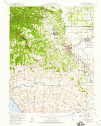
1954 Map of Sebastopol
USGS Topo · Published 1959About this map
The Russian River winds through the northern reaches of this Sonoma County landscape, passing through resort communities like Guerneville and Mirabel Park during a mid-century era of agricultural dominance. To the south, the terrain transitions from the densely wooded Bohemian Grove and Joy Woods Redwood Tree Farm into the open valley floors of the Cañada De Jonive and Cañada De Pogolimi. The map illustrates a region defined by its specialized farming, notably the apple orchards surrounding Sebastopol as evidenced by the Gravenstein Highway.
Find a feature on this map
114 named features on this map. Tap any name to fly to it.
Don’t see what you’re looking for? This feature index may not catch every label — zoom into the map to look around manually.
Map Details
Editions of this 1954 Sebastopol Map
This is the sole edition of this map. No revisions or reprints were ever made.
Other maps of this area

1914 · Petaluma
USGS Topo · 1:62,500

1916 · Santa Rosa
USGS Topo · 1:62,500

1916 · Point Reyes
USGS Topo · 1:48,000

1918 · Point Reyes
USGS Topo · 1:62,500

1920 · Healdsburg
USGS Topo · 1:62,500

1921 · Skaggs
USGS Topo · 1:62,500

1927 · Calistoga
USGS Topo · 1:62,500

1933 · Healdsburg
USGS Topo · 1:48,000

1935 · Sebastopol
USGS Topo · 1:48,000

1940 · Healdsburg
USGS Topo · 1:62,500