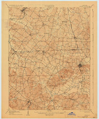
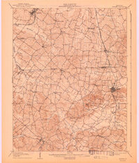
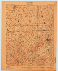
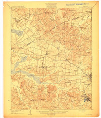
1906 Map of Sebree
USGS Topo · Published 1930About this map
Sebree and the surrounding Henderson and Webster County borderlands are defined by a network of small agricultural settlements and early rail corridors in the first decade of the twentieth century. The town of Sebree is a focal point near Sebree Springs, while the Louisville and Nashville R R passes through Robards to the north. In the western portion of the region, the Illinois Central R R connects Corydon and the community of Jones. Local community life is rooted in landmarks like the Oakland Schoolhouse and Cherry Hill Church. The landscape transitions from the drainage basins of Highland Creek and Canoe Creek to more prominent elevations such as Bald Knob and Beal Hill in the south, reflecting the varied topography of this coal-bearing Kentucky region.
Find a feature on this map
44 named features on this map. Tap any name to fly to it.
Don’t see what you’re looking for? This feature index may not catch every label — zoom into the map to look around manually.
Map Details
Editions of this 1906 Sebree Map
3 editions found
Other maps of this area
1905 · Newburg
USGS Topo · 1:62,500
1906 · Sebree
USGS Topo · 1:62,500

1907 · Earlington
USGS Topo · 1:48,000

1907 · Morganfield
USGS Topo · 1:62,500

1908 · Calhoun
USGS Topo · 1:62,500
1909 · Earlington
USGS Topo · 1:62,500

1909 · Madisonville
USGS Topo · 1:62,500
1909 · Providence
USGS Topo · 1:62,500

1914 · Henderson
USGS Topo · 1:48,000
1916 · Henderson
USGS Topo · 1:62,500