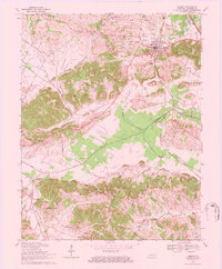
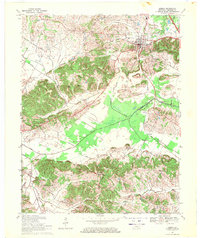
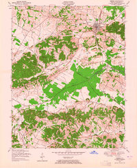
1969 Map of Sebree
USGS Topo · Published 1984About this map
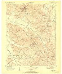
The Louisville and Nashville railroad corridor anchors this late 1960s study of the Webster County landscape, where the town of Sebree stands as a focal point of commerce and settlement. The map reveals an area defined by agricultural drainage and fossil fuel extraction, evidenced by numerous Oil Wells, a Gas Well, and the prominent pipelines traversing the terrain. Smaller rural centers like Pratt, Ortiz, and Gatesville appear alongside a network of country churches including Mt Lebanon Ch and Sebree Springs Ch, providing key touchpoints for genealogical research.
Find a feature on this map
50 named features on this map. Tap any name to fly to it.
Don’t see what you’re looking for? This feature index may not catch every label — zoom into the map to look around manually.
Map Details
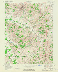
Editions of this 1969 Sebree Map
2 editions found
Other maps of this area
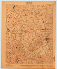
1906 · Sebree
USGS Topo · 1:62,500

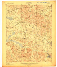
1907 · Earlington
USGS Topo · 1:48,000

1908 · Calhoun
USGS Topo · 1:62,500
1909 · Earlington
USGS Topo · 1:62,500

1909 · Madisonville
USGS Topo · 1:62,500
1949 · Sebree
USGS Topo · 1:24,000
1949 · Poole
USGS Topo · 1:24,000
1949 · Robards
USGS Topo · 1:24,000
1951 · Dixon
USGS Topo · 1:24,000
1951 · Poole
USGS Topo · 1:24,000