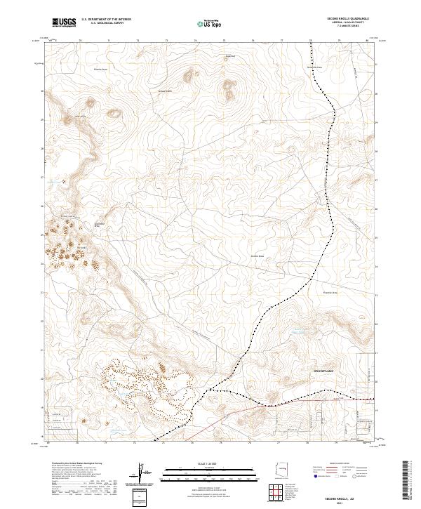
2021 Map of Second Knolls
USGS Topo · Published 2021About this map
Snowflake sits at the southeastern edge of this high-desert landscape in Navajo County, where the transition from organized town streets to the open ranchland of the Colorado Plateau is immediate. The terrain is defined by a series of drainage systems, including Tenmile Draw, Ninemile Draw, and Fivemile Draw, which carve through a landscape dotted with volcanic and sedimentary landmarks like Sugarloaf and the eponymous Second Knolls.
Find a feature on this map
37 named features on this map. Tap any name to fly to it.
Don’t see what you’re looking for? This feature index may not catch every label — zoom into the map to look around manually.
Map Details
Editions of this 2021 Second Knolls Map
This is the sole edition of this map. No revisions or reprints were ever made.
Other maps of this area

1886 · Holbrook
USGS Topo · 1:250,000

1893 · Holbrook
USGS Topo · 1:250,000

1954 · Holbrook
USGS Topo · 1:250,000

1957 · Holbrook
USGS Topo · 1:250,000

1958 · Holbrook
USGS Topo · 1:250,000

1960 · Holbrook
USGS Topo · 1:250,000

1961 · Clay Springs
USGS Topo · 1:62,500
1970 · Cactus Flat
USGS Topo · 1:24,000
1970 · Taylor
USGS Topo · 1:24,000
1970 · Second Knolls
USGS Topo · 1:24,000