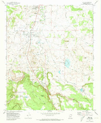
1970 Map of Taylor
USGS Topo · Published 1973About this map
Silver Creek winds through this central Navajo County landscape, anchoring the neighboring settlements of Snowflake and Taylor during the early 1970s. The map illustrates a developed agricultural and industrial corridor, where an extensive network of infrastructure including The Canal, Millet Swale Dam, and various siphons and aqueducts support the arid terrain. The presence of Paper Mill Road and an Old Railroad Grade indicates the area's economic foundations in timber and transport. To the south, the terrain rises toward Shumway Butte and the northern boundary of the Sitgreaves National Forest, where the small community of Shumway sits near the confluence of Show Low Creek. Local history is preserved in the location of the Taylor Cem and Shumway Cem, as well as established educational sites like the Snowflake Jr High Sch.
Find a feature on this map
42 named features on this map. Tap any name to fly to it.
Don’t see what you’re looking for? This feature index may not catch every label — zoom into the map to look around manually.
Map Details
Editions of this 1970 Taylor Map
This is the sole edition of this map. No revisions or reprints were ever made.
Other maps of this area

1886 · St Johns
USGS Topo · 1:250,000

1886 · Holbrook
USGS Topo · 1:250,000

1892 · St Johns
USGS Topo · 1:250,000

1893 · Holbrook
USGS Topo · 1:250,000

1954 · Holbrook
USGS Topo · 1:250,000

1954 · Saint Johns
USGS Topo · 1:250,000

1957 · Holbrook
USGS Topo · 1:250,000

1957 · Saint Johns
USGS Topo · 1:250,000

1958 · Saint Johns
USGS Topo · 1:250,000

1958 · Holbrook
USGS Topo · 1:250,000