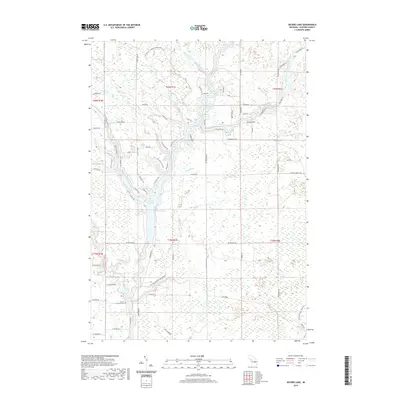
2019 Map of Secord Lake
USGS Topo · Published 2019About this map
Secord Lake forms the heart of this landscape, where the confluence of several major waterways creates a complex system of peninsulas and waterfront properties. The geography is defined by the convergence of the West Branch Tittabawassee River, Middle Branch Tittabawassee River, and East Branch Tittabawassee River, along with the Sugar River flowing in from the west. This intricate drainage network, including Indian Lake Creek and Elk Lake Creek, influenced the local road patterns, such as Lakeshore Dr and Riverside Dr, which hug the winding shorelines. Evidence of early community settlement is preserved at the Second Lutheran Cem near the southern edge of the lake. The map also documents smaller hydrologic features like Lang Drain and Gilman Spring, illustrating the transition from natural river systems to managed water resources in Gladwin County.
Find a feature on this map
80 named features on this map. Tap any name to fly to it.
Don’t see what you’re looking for? This feature index may not catch every label — zoom into the map to look around manually.
Map Details
Editions of this 2019 Secord Lake Map
This is the sole edition of this map. No revisions or reprints were ever made.
Other maps of this area

1954 · Traverse City
USGS Topo · 1:250,000

1954 · Midland
USGS Topo · 1:250,000

1958 · Traverse City
USGS Topo · 1:250,000

1958 · Midland
USGS Topo · 1:250,000

1959 · Midland
USGS Topo · 1:250,000

1966 · Midland
USGS Topo · 1:250,000

1968 · Sterling SW
USGS Topo · 1:24,000

1968 · Sterling NW
USGS Topo · 1:24,000

1969 · Edwards
USGS Topo · 1:24,000

1969 · Butman
USGS Topo · 1:24,000