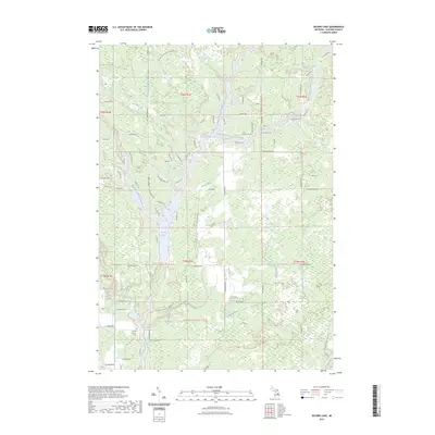
2023 Map of Secord Lake
USGS Topo · Published 2023About this map
Secord Lake and its intricate shoreline dominate this portion of Gladwin County, where several major tributaries converge. The Middle Branch, West Branch, and East Branch Tittabawassee Rivers all flow into this reservoir, creating a landscape defined by water and narrow peninsulas. Near the southern end of the lake, Secord Dam Rd crosses the terrain just north of where the Sugar River joins the main flow. Local history is anchored by the Second Lutheran Cem on the western shore near Old Secord Rd. Significant recreational infrastructure is visible via the Midland To Mackinaw Boy Scout Trl, which winds across the southern reaches near Gilman Spring and Tea Creek. The map details a transition from dense residential road networks along the waterfront to more rural sections like E Ridge and the Molasses River corridor.
Find a feature on this map
81 named features on this map. Tap any name to fly to it.
Don’t see what you’re looking for? This feature index may not catch every label — zoom into the map to look around manually.
Map Details
Editions of this 2023 Secord Lake Map
This is the sole edition of this map. No revisions or reprints were ever made.
Other maps of this area

1954 · Traverse City
USGS Topo · 1:250,000

1954 · Midland
USGS Topo · 1:250,000

1958 · Traverse City
USGS Topo · 1:250,000

1958 · Midland
USGS Topo · 1:250,000

1959 · Midland
USGS Topo · 1:250,000

1966 · Midland
USGS Topo · 1:250,000

1968 · Sterling SW
USGS Topo · 1:24,000

1968 · Sterling NW
USGS Topo · 1:24,000

1969 · Edwards
USGS Topo · 1:24,000

1969 · Butman
USGS Topo · 1:24,000