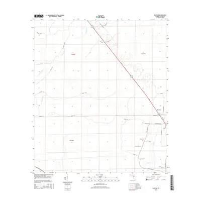
2015 Map of Secotan
USGS Topo · Published 2015About this map
Secotan serves as a central point in this rural Taylor County landscape, situated where SR 20 bisects the terrain. The area is defined by its extensive network of timber roads and family-named routes, such as Mutt Andrews Rd, Burley Brannen Rd, and Slaughter Rd. The Econfina River meanders through the western portion of the quadrangle, contrasted by the straighter lines of historical logging or rail paths like The New Grade. To the south, the presence of W Hampton Springs Ave and Pisgah Church Rd suggests established community centers and historical transit corridors. This map reveals a distinct pattern of land division and resource management, with named tracks like Meatball Express Rd and Fulford Bridge Rd providing access across the low-lying reaches of the Rocky Cr drainage system.
Find a feature on this map
34 named features on this map. Tap any name to fly to it.
Don’t see what you’re looking for? This feature index may not catch every label — zoom into the map to look around manually.
Map Details
Editions of this 2015 Secotan Map
This is the sole edition of this map. No revisions or reprints were ever made.
Other maps of this area

1952 · Secotan
USGS Topo · 1:24,000

1954 · Johnson Hammock
USGS Topo · 1:24,000

1954 · Boyd
USGS Topo · 1:24,000

1954 · Hampton Springs
USGS Topo · 1:24,000

1954 · Secotan
USGS Topo · 1:24,000

1954 · Valdosta
USGS Topo · 1:250,000

1955 · Perry
USGS Topo · 1:24,000

1955 · Shady Grove
USGS Topo · 1:24,000

1955 · Lamont SE
USGS Topo · 1:24,000

1955 · Greenville SE
USGS Topo · 1:24,000