
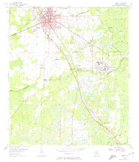
1955 Map of Perry
USGS Topo · Published 1956About this map
Perry stands as the central hub of this 1950s survey, showing a landscape defined by timber, transportation, and low-lying coastal plains. The industrial footprint of the Foley settlement and the Perry-Foley Airport highlight the mid-century development of Taylor County. Two major rail lines, the Southern and the Atlantic Coast Line, intersect at Bucell Junction, facilitating the movement of materials through the wetlands and forests.
Find a feature on this map
29 named features on this map. Tap any name to fly to it.
Don’t see what you’re looking for? This feature index may not catch every label — zoom into the map to look around manually.
Map Details
Editions of this 1955 Perry Map
3 editions found
Other maps of this area

1952 · Secotan
USGS Topo · 1:24,000

1954 · Fenholloway
USGS Topo · 1:24,000

1954 · Warrior Swamp
USGS Topo · 1:24,000

1954 · Salem
USGS Topo · 1:24,000

1954 · Boyd
USGS Topo · 1:24,000

1954 · Hampton Springs
USGS Topo · 1:24,000

1954 · Secotan
USGS Topo · 1:24,000

1954 · Day NW
USGS Topo · 1:24,000

1954 · Okefenokee Slough
USGS Topo · 1:24,000

1954 · Gainesville
USGS Topo · 1:250,000