
1954 Map of Okefenokee Slough
USGS Topo · Published 1956About this map
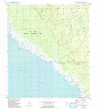
The tidal marshes and swampy lowlands of the Taylor County coast are captured here during the mid-1950s, a landscape defined by its intricate network of waterways emptying into the Gulf of Mexico. Small coastal outposts and landings serve as the primary human footprint, including Spring Warrior Camp, Yates Camp, and Adams Beach. These sites are linked by an Old Railroad Grade that cuts through the dense wetlands of the Okefenokee Slough and Eagle Prairie, suggesting a legacy of timber harvesting or earlier industrial access that has since yielded to more seasonal or recreational use.
Find a feature on this map
24 named features on this map. Tap any name to fly to it.
Don’t see what you’re looking for? This feature index may not catch every label — zoom into the map to look around manually.
Map Details
Editions of this 1954 Okefenokee Slough Map
2 editions found
Other maps of this area

1954 · Warrior Swamp
USGS Topo · 1:24,000

1954 · Hampton Springs
USGS Topo · 1:24,000

1954 · Keaton Beach
USGS Topo · 1:24,000

1954 · Gainesville
USGS Topo · 1:250,000

1954 · Valdosta
USGS Topo · 1:250,000

1955 · Perry
USGS Topo · 1:24,000

1955 · Rock Islands
USGS Topo · 1:24,000

1955 · Manlin Hammock
USGS Topo · 1:24,000
1956 · Hampton Springs
USGS Topo · 1:25,000

1958 · Valdosta
USGS Topo · 1:250,000