
1954 Map of Warrior Swamp
USGS Topo · Published 1955About this map
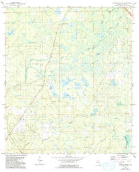
Huxford Camp and the nearby Huxford Lookout Tower serve as the primary human landmarks in this mid-century survey of the Taylor County wilderness. The landscape is dominated by an intricate network of wetlands, characterized by Spring Warrior Creek, Middle Warrior Creek, and the expansive White Oak Swamp to the southeast. The interior is punctuated by numerous named water bodies, including Cypress Lake, George Ann Lake, and Bear Harbor Lake, reflecting a terrain defined by seasonal inundation and poorly drained soils.
Find a feature on this map
17 named features on this map. Tap any name to fly to it.
Don’t see what you’re looking for? This feature index may not catch every label — zoom into the map to look around manually.
Map Details
Editions of this 1954 Warrior Swamp Map
2 editions found
Other maps of this area

1954 · Fenholloway
USGS Topo · 1:24,000

1954 · Salem SW
USGS Topo · 1:24,000

1954 · Salem
USGS Topo · 1:24,000

1954 · Hampton Springs
USGS Topo · 1:24,000

1954 · Keaton Beach
USGS Topo · 1:24,000

1954 · Okefenokee Slough
USGS Topo · 1:24,000

1954 · Gainesville
USGS Topo · 1:250,000

1954 · Valdosta
USGS Topo · 1:250,000

1955 · Perry
USGS Topo · 1:24,000
1956 · Hampton Springs
USGS Topo · 1:25,000