
1954 Map of Day NW
USGS Topo · Published 1955About this map
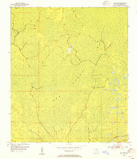
San Pedro Bay dominates this mid-century landscape in Taylor County, characterized by an extensive wetland environment and subtle elevation changes. The southern portion of the sheet reveals the winding course of the Fenholloway River, which serves as a primary drainage feature for the surrounding swampy terrain. This 1954 survey captures the area before significant modern drainage or development, highlighting the natural hydrological patterns of north Florida. Industrial activity of the era is evident along the southeastern edge where the Southern railroad line cuts through the marshy lowlands. Local landmarks like the Spoil Bank indicate historical earth-moving or canal-clearing activities, providing insight into early attempts to manage this water-heavy landscape for timber or transit.
Find a feature on this map
6 named features on this map. Tap any name to fly to it.
Don’t see what you’re looking for? This feature index may not catch every label — zoom into the map to look around manually.
Map Details
Editions of this 1954 Day NW Map
3 editions found
Other maps of this area

1954 · Fenholloway
USGS Topo · 1:24,000

1954 · Day SE
USGS Topo · 1:24,000

1954 · Day
USGS Topo · 1:24,000

1954 · Boyd
USGS Topo · 1:24,000

1954 · Valdosta
USGS Topo · 1:250,000

1955 · Perry
USGS Topo · 1:24,000

1955 · Greenville SE
USGS Topo · 1:24,000

1958 · Valdosta
USGS Topo · 1:250,000

1958 · Madison SW
USGS Topo · 1:24,000

1958 · Madison SE
USGS Topo · 1:24,000