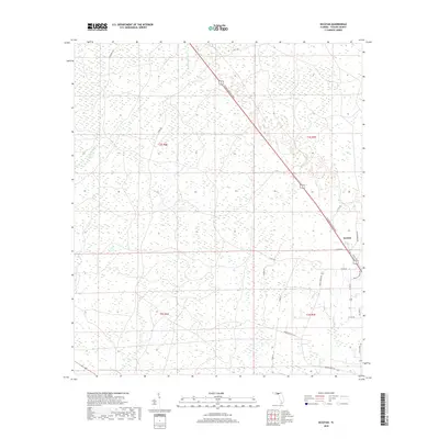
2018 Map of Secotan
USGS Topo · Published 2018About this map
Secotan serves as a primary reference point in this Taylor County landscape, situated where the N Byron Butler Pkwy cuts a straight diagonal path through the low-lying wetlands. The geography is defined by the winding course of the Econfina River and its southern counterpart, Rocky Cr, which drain through heavily saturated terrain marked by a network of drainage channels and cypress stands. This area remains largely rural, dominated by a grid of county roads and family-named routes such as Sid Russell Rd and Paul Poppell Rd. A clear division of land use is visible between the north and south sections, with the northern reaches of t3s r6e showing a more consistent swampy character compared to the slightly more road-dense area surrounding Pisgah Church Rd to the southeast.
Find a feature on this map
26 named features on this map. Tap any name to fly to it.
Don’t see what you’re looking for? This feature index may not catch every label — zoom into the map to look around manually.
Map Details
Editions of this 2018 Secotan Map
This is the sole edition of this map. No revisions or reprints were ever made.
Other maps of this area

1952 · Secotan
USGS Topo · 1:24,000

1954 · Johnson Hammock
USGS Topo · 1:24,000

1954 · Boyd
USGS Topo · 1:24,000

1954 · Hampton Springs
USGS Topo · 1:24,000

1954 · Secotan
USGS Topo · 1:24,000

1954 · Valdosta
USGS Topo · 1:250,000

1955 · Perry
USGS Topo · 1:24,000

1955 · Shady Grove
USGS Topo · 1:24,000

1955 · Lamont SE
USGS Topo · 1:24,000

1955 · Greenville SE
USGS Topo · 1:24,000