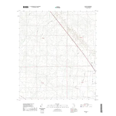
2021 Map of Secotan
USGS Topo · Published 2021About this map
The Ecofina River meanders through the northwest corner of this Taylor County landscape, which is largely defined by its wetland networks and managed timber tracks. Modern transportation corridors like the N Byron Butler Pkwy bisect the terrain, providing a contemporary link through the settlement of Secotan. This area is characterized by numerous small creeks and drainages, most notably Rocky Cr, which threads through the southeastern quadrant alongside roads named for local families and landmarks. The map reveals a transition between established thoroughfares and more primitive routes such as the Buckeye Trl and River Rd. Researchers of local history will find interest in the naming of rural ways like Pisgah Church Rd and Granthum Hill Rd, which point to the social and family-based foundations of this Florida coastal plain region.
Find a feature on this map
28 named features on this map. Tap any name to fly to it.
Don’t see what you’re looking for? This feature index may not catch every label — zoom into the map to look around manually.
Map Details
Editions of this 2021 Secotan Map
This is the sole edition of this map. No revisions or reprints were ever made.
Other maps of this area

1952 · Secotan
USGS Topo · 1:24,000

1954 · Johnson Hammock
USGS Topo · 1:24,000

1954 · Boyd
USGS Topo · 1:24,000

1954 · Hampton Springs
USGS Topo · 1:24,000

1954 · Secotan
USGS Topo · 1:24,000

1954 · Valdosta
USGS Topo · 1:250,000

1955 · Perry
USGS Topo · 1:24,000

1955 · Shady Grove
USGS Topo · 1:24,000

1955 · Lamont SE
USGS Topo · 1:24,000

1955 · Greenville SE
USGS Topo · 1:24,000