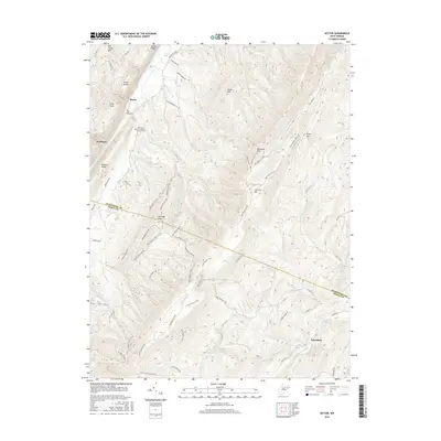
2016 Map of Sector
USGS Topo · Published 2016About this map
The South Branch Potomac River carves a deep valley through the mountains of Hampshire and Hardy counties, defining the western edge of this landscape. Near the riverside settlement of Sector, the topography is dominated by steep-sided heights including Mill Creek Mtn and the prominent gorge known as The Trough. Local heritage is anchored by the Saint Luke Presbyterian Church Cem on the high ground overlooking the river valley, a central landmark for the surrounding rural community. To the south and east, the terrain transitions into a dense network of ridges such as Nathaniel Mtn and S Branch Mtn. Small settlements like Wickham and Inkerman are situated along winding mountain roads and secondary waterways like the N River, reflecting the isolated, topography-driven settlement patterns of the Potomac Highlands.
Find a feature on this map
55 named features on this map. Tap any name to fly to it.
Don’t see what you’re looking for? This feature index may not catch every label — zoom into the map to look around manually.
Map Details
Editions of this 2016 Sector Map
This is the sole edition of this map. No revisions or reprints were ever made.
Other maps of this area

1891 · Romney
USGS Topo · 1:125,000

1920 · Moorefield
USGS Topo · 1:62,500

1920 · Keyser
USGS Topo · 1:62,500

1921 · Keyser
USGS Topo · 1:48,000

1921 · Hanging Rock
USGS Topo · 1:48,000

1921 · Moorefield
USGS Topo · 1:48,000

1922 · Moorefield
USGS Topo · 1:62,500

1922 · Wardensville
USGS Topo · 1:62,500

1922 · Keyser
USGS Topo · 1:62,500

1923 · Hanging Rock
USGS Topo · 1:62,500