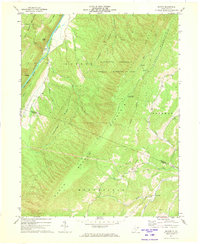
1971 Map of Sector
USGS Topo · Published 1973About this map
The South Branch Potomac River carves a dramatic path through the valley here, defining the landscape between Nathaniel Mountain and the high ridges to the west. This 1971 field-checked survey reveals a quiet agricultural and hunting corridor along the Baltimore and Ohio railroad line, which follows the river's bend through the steep gorge known as The Trough. Small communities like Sector and Inkerman anchor the local geography, connected by a network of trails and secondary roads that navigate the complex drainage systems of Pot Lick Run and Skaggs Run.
Find a feature on this map
41 named features on this map. Tap any name to fly to it.
Don’t see what you’re looking for? This feature index may not catch every label — zoom into the map to look around manually.
Map Details
Editions of this 1971 Sector Map
This is the sole edition of this map. No revisions or reprints were ever made.
Other maps of this area

1891 · Romney
USGS Topo · 1:125,000

1920 · Moorefield
USGS Topo · 1:62,500

1920 · Keyser
USGS Topo · 1:62,500

1921 · Keyser
USGS Topo · 1:48,000

1921 · Hanging Rock
USGS Topo · 1:48,000

1921 · Moorefield
USGS Topo · 1:48,000

1922 · Moorefield
USGS Topo · 1:62,500

1922 · Wardensville
USGS Topo · 1:62,500

1922 · Keyser
USGS Topo · 1:62,500

1923 · Hanging Rock
USGS Topo · 1:62,500