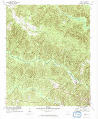
1969 Map of Sedalia
USGS Topo · Published 1973About this map
The Sumter National Forest dominates this Piedmont landscape, where the confluence of rivers and creeks historically shaped the settlement of Union, Laurens, and Newberry counties. In the late 1960s, the terrain was defined by the winding paths of the Enoree River and Tyger River, with the small community of Sedalia and the northern edge of Whitmire serving as local hubs. The presence of the Old Quaker Cem and Padgetts Creek Ch suggests deep roots in the area's early religious and social history, likely predating the formal boundaries of Rose Hill State Park.
Find a feature on this map
22 named features on this map. Tap any name to fly to it.
Don’t see what you’re looking for? This feature index may not catch every label — zoom into the map to look around manually.
Map Details
Editions of this 1969 Sedalia Map
2 editions found
Other maps of this area

1941 · Spartanburg
USGS Topo · 1:250,000

1953 · Spartanburg
USGS Topo · 1:250,000

1960 · Spartanburg
USGS Topo · 1:250,000

1963 · Spartanburg
USGS Topo · 1:250,000

1964 · Spartanburg
USGS Topo · 1:250,000

1969 · Whitmire South
USGS Topo · 1:24,000

1969 · Cross Anchor
USGS Topo · 1:24,000

1969 · Newberry NW
USGS Topo · 1:24,000

1969 · Union West
USGS Topo · 1:24,000

1969 · Sedalia
USGS Topo · 1:24,000