
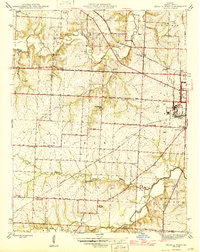
1946 Map of Sedalia West
USGS Topo · Published 1946About this map
Sedalia and the surrounding agricultural landscape of Prairie and Dresden townships are captured here in the mid-1940s. The map highlights the western edge of the city, including the expansive State Fair Grounds and the Radio Sta KDRO tower. This period shows a community organized around a dense network of rural one-room schoolhouses like Quisenberry Sch, Jackson Sch, and Oak Grove Sch, many of which served as local landmarks for generations of farming families.
Find a feature on this map
44 named features on this map. Tap any name to fly to it.
Don’t see what you’re looking for? This feature index may not catch every label — zoom into the map to look around manually.
Map Details
Editions of this 1946 Sedalia West Map
2 editions found
Other maps of this area

1887 · Sedalia
USGS Topo · 1:125,000

1894 · Sedalia
USGS Topo · 1:125,000

1939 · Sweet Springs
USGS Topo · 1:62,500

1940 · Sweet Springs
USGS Topo · 1:62,500

1941 · Sweet Springs
USGS Topo · 1:62,500

1944 · Sedalia West
USGS Topo · 1:24,000

1944 · Sedalia East
USGS Topo · 1:24,000

1945 · Sweet Springs
USGS Topo · 1:62,500

1946 · Sedalia East
USGS Topo · 1:24,000

1947 · Jefferson City
USGS Topo · 1:250,000