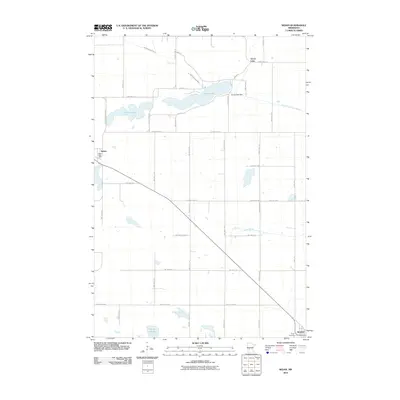
2010 Map of Sedan
USGS Topo · Published 2010About this map
The small community of Sedan sits at the intersection of a vast grid of township and county roads, reflecting the agricultural character of Stearns County at the start of the 21st century. The map highlights the local infrastructure of the era, from the Sedan Post Office in the village center to the Grove Lake Dam regulating the waters of Grove Lake. This waterway, along with the North Fork Crow River, forms a vital drainage system through the prairie landscape, connecting with McCloud Lake and the marshy Tracey Slough. On the southern edge of the survey, a portion of Brooten is visible near Trinity Cemetery, serving as a landmark for local genealogy and history. The landscape is defined by its rectilinear property lines and drainage features like Sedan Brook, showing how modern surveying and land use have shaped this corner of Minnesota.
Find a feature on this map
40 named features on this map. Tap any name to fly to it.
Don’t see what you’re looking for? This feature index may not catch every label — zoom into the map to look around manually.
Map Details
Editions of this 2010 Sedan Map
This is the sole edition of this map. No revisions or reprints were ever made.
Other maps of this area

1953 · Saint Cloud
USGS Topo · 1:250,000

1957 · Saint Cloud
USGS Topo · 1:250,000

1958 · Saint Cloud
USGS Topo · 1:250,000

1965 · Westport
USGS Topo · 1:24,000

1965 · Padua
USGS Topo · 1:24,000

1965 · Sedan
USGS Topo · 1:24,000

1965 · Raymond Lake
USGS Topo · 1:24,000

1967 · Belgrade
USGS Topo · 1:24,000

1967 · Lake Johanna
USGS Topo · 1:24,000

1968 · Terrace
USGS Topo · 1:24,000